The hike to the Tegernseer Hütte has everything a seasoned hiker is looking for: multiple summit options, an impressively situated hut, optional climbing spots and a magnificent Alpine panorama. It’s one of the most popular hikes south of Tegernsee, but thw views are more than worth it.
Details
Moderate9 km
5 hours
900 m elevation
Directions & Parking
By Car:
Drivers can find the hiking car park Roß- and Buchstein along the Achenpassstraße B 307 (view in Google Maps) south of Tegernsee.
By Train:
Take the Bavarian Regiobahn (BRB) from Munich to Tegernsee. From Tegernsee station you can take the RVO Bus towards Stuben/Pertisau, getting off at the “Tegernseer Hütte” stop.
Trail Description
From hiking car park to Sonnberg Alm
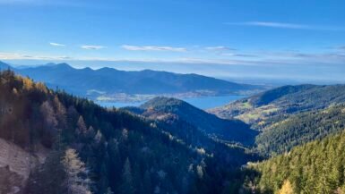
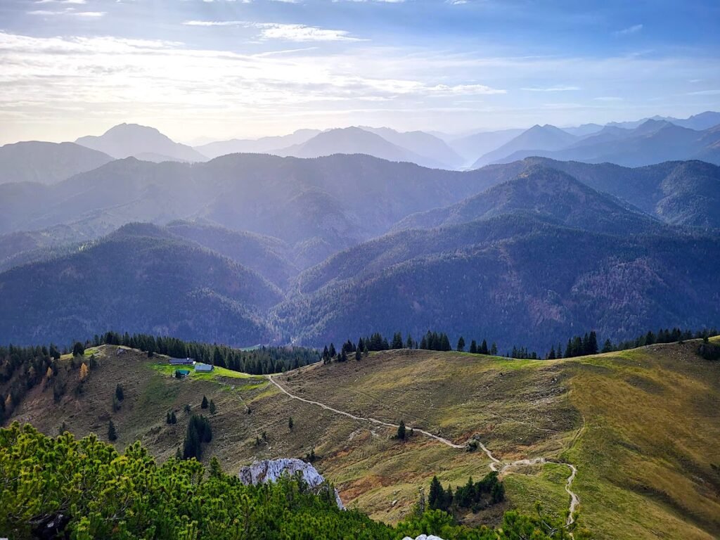
The hike to the Tegernseer Hütte starts at the Roßstein and Buchstein hiking car park. You can expect a steep start with 600 m of the 900 m elevation right at the beginning of the route. The path takes you first over steps and onwards through a shady forest to the first stop of the tour, the Sonnberg Alm. Here the forest starts to thin out and reveals the view of the mountains and peaks south of Lake Tegernsee.
The route to the Tegernseer Hütte, Roßstein and Buchstein is consistently wellsignposted so that it’s almost impossible to veer off the path along the way.
Sonnberg Alm to Roßstein and Tegernseer Hütte
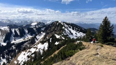
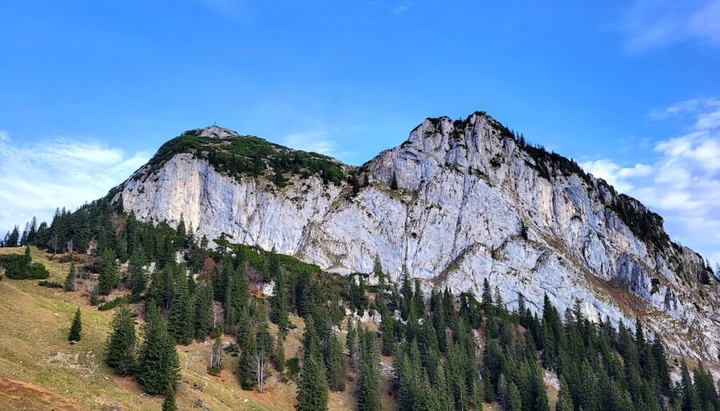
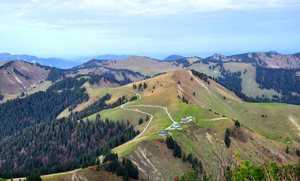
Shortly before the Sonnberg Alm, after a little more than an hour, the character of the hike changes and the initially strenuous hike turns into a wonderfully scenic high-altitude tour. With most of the elevation behing you, you can enjoy the first unobstructed views of the summit of the Roßstein, the Buchstein and the Tegernseer Hütte.
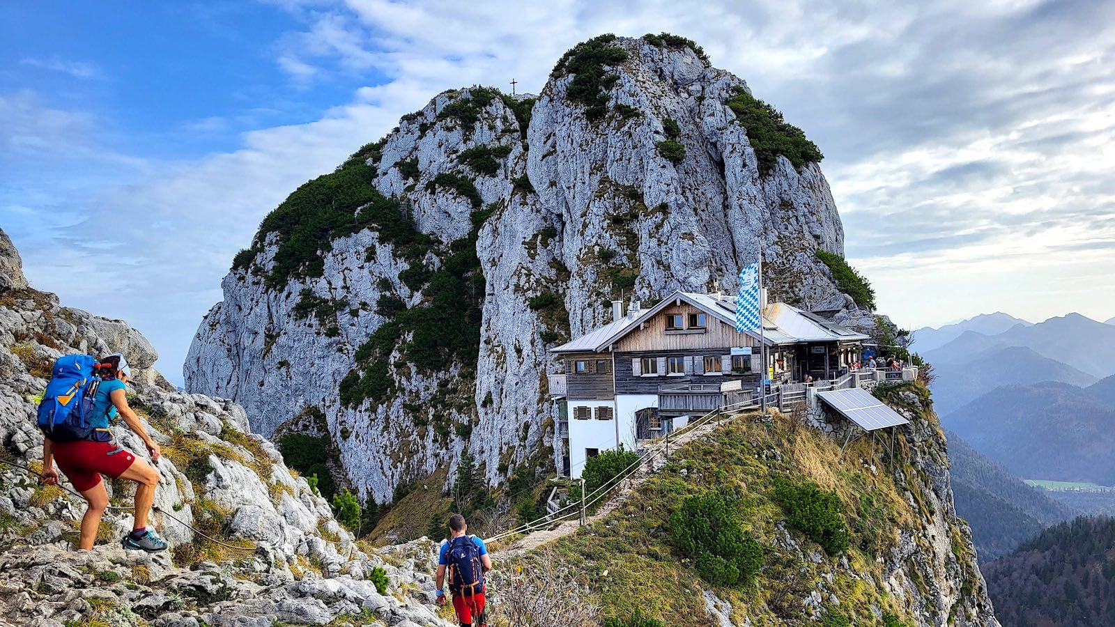
For the final stretch you’ll need to decide between two paths: either the demanding, shorter ascent, which is signposted as dangerous. Or the 20-minute longer ascent without climbing sections. The ascent described here is the shorter one and is signposted as dangerous.
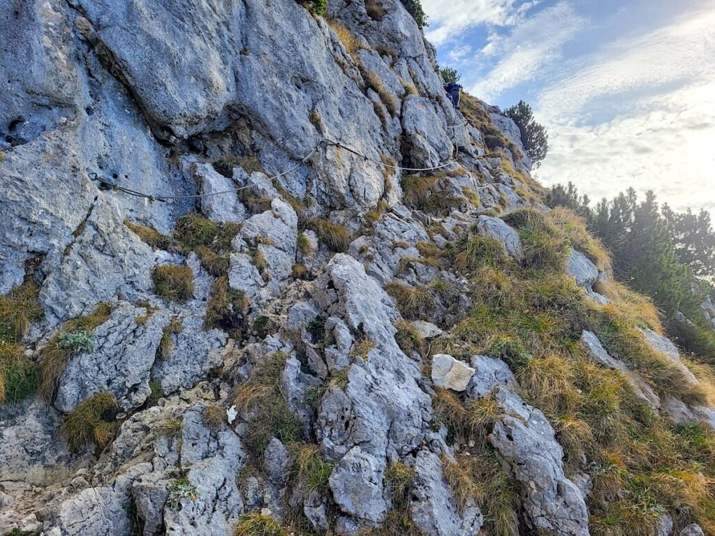
Now the scramble to the summit begins. Sure-footedness and a head for heights are essential, this section shouldnt pose a problem for experienced hikers. The critical climbing points are secured with steel cables. The ascent is however not recommended in wet conditions. The level of difficulty is roughly comparable to the climbing sections on the Schildenstein, or the hike to the Brecherspitz at Spitzingsee.
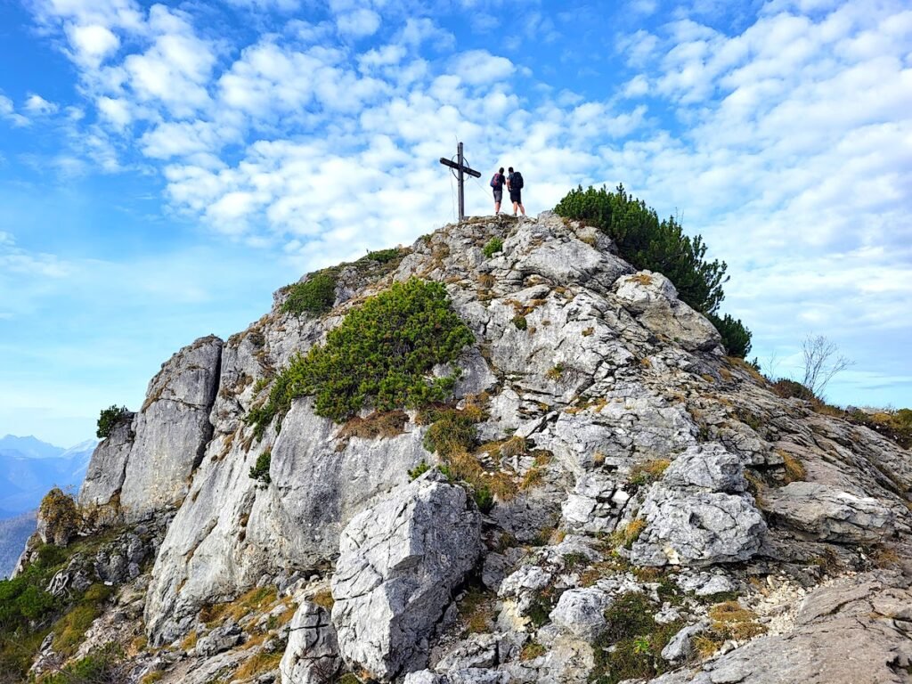
The Tegernseer Hütte is within sight of the summit. It takes about 10 minutes from the summit to the hut. The hut in its current form between Rossstein and Buchstein has been here since 1967. On beautiful hiking days it can get tight on the beautiful, small sun terrace.
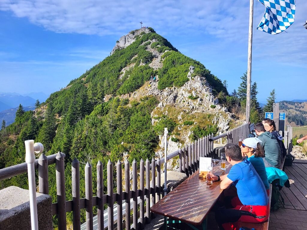
If you arrive early in the day, you can grab one of the seats directly on the fence in front of a steep drop with a magnificent view to the south. Due to the exposed location and the difficult supply logistics, you can expect a small menu including Wiener, soups and cakes.
From Tegernseer Hütte back to the hiking car park
The descent starts initialy in the direction of Buchstein. Climbing the Buchstein is optional but highly recommended.
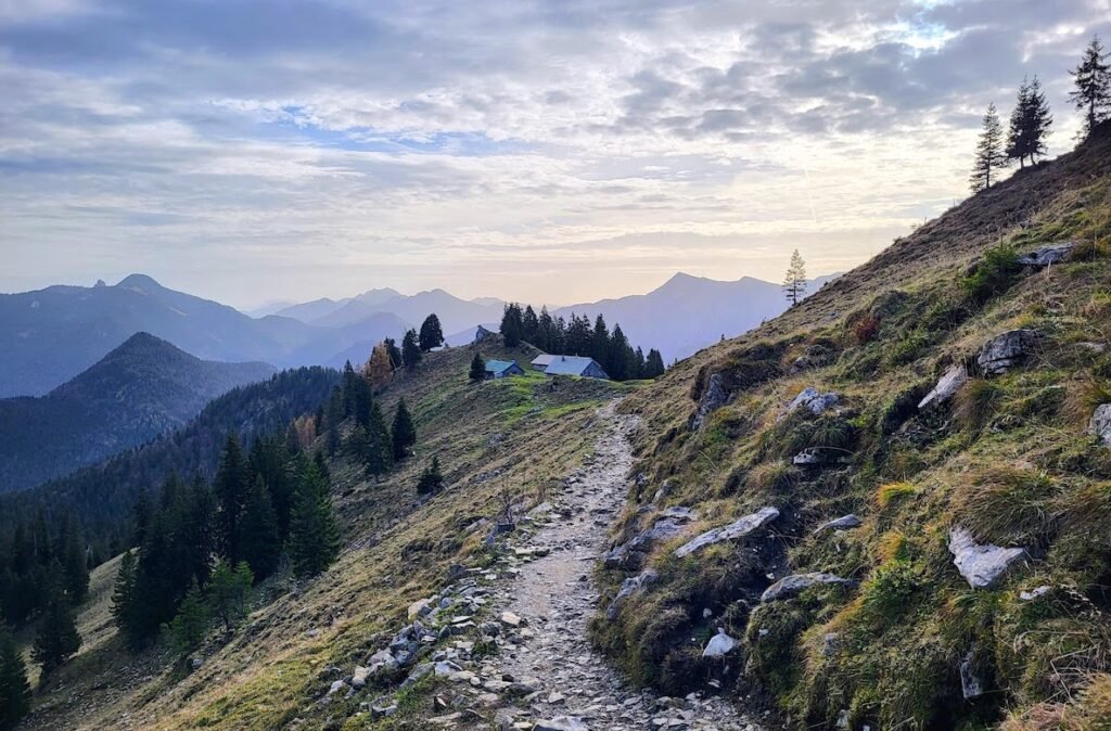
After a few hundred meters you’ll need to choose your route for the descent. Either you hike back to the hiking car park on the path described here. If you’re traveling by bus or train, the descent and onward hike to the Schwarzentenn Alm in a northerly direction is a nice alternative. It takes a little over two hours to get there. From the Schwarzentenn Alm it’s an hour hike down to the RVO bus back to Tegernsee .
The circular hike described here first follows the signs towards the Roßsteinalm, continuing on to the Roßstein and Buchstein hiking car park. Similar to the ascent, the descent is also excellently signposted. You should plan around three hours for the hike from the Roßsteinalm back to the hiking car park,
Summary
Start as early as you can! The Tegernseer Hütte is one of the most popular (busy) hiking destinations on Lake Tegernsee due to its exceptional location and good summit opportunities. If you want to take in the summit of the Roßstein, be prepared for climbing areas. Despite the fact that this is only a moderately difficult hike, a good level of fitness is recommended in order to be able to fully enjoy this wonderful circular tour.