Despite some challenging sections, the hike to the Schildenstein (1613 m) is one of the most popular hikes south of Lake Tegernsee. And with good reason: the hike offers not only impressive scenery through the Wolfsschlucht gorge with its two waterfalls, you can expect a magnificent view from the Schildenstein despite its relatively low altitude. Two mountain huts along the loop tour guarantee a stop for a beer and a snack on the way.
Trail Details
Difficult14 km
6 hours
900m elevation
Directions and Parking
By Car:
The Siebenhütten hiking car park on the Achenpassstraße B 307 is best suited for those arriving by car (Link to Google Maps). If the car park is full, you can usually find a spot at the car park “Wanderparkplatz Wildbad Kreuth” (Link to Google Maps).
With Public Transport:
Take the Bayerischen Regiobahn (BRB) train from Munich to Tegernsee. Board the RVO Bus to Stuben/Pertisau leaving from outside the station and get off at the stop “Siebenhütten”.
Description
The six-hour hike is split into the following sections:
Car Park – Siebenhütten (30 minutes)
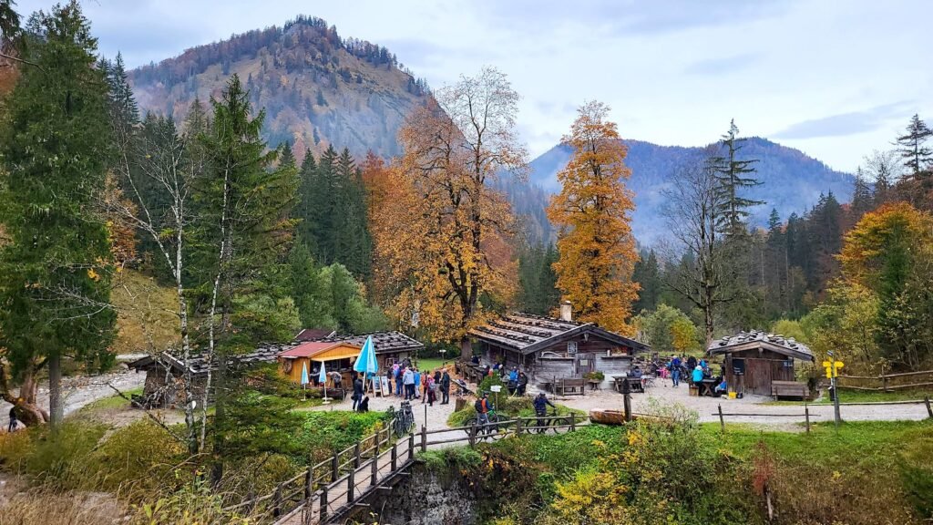
The hike starts at the Siebenhütten car park (alternatively from the Wildbad Kreuth hiker’s car park). Follow the signs from here for “Schildenstein via Wolfsschlucht”. After about half an hour you’ll reach the Siebenhütten alpine inn. The easy hike to Siebenhütten is a popular hiking destination itself particularly for families.
Siebenhütten – Wolfsschlucht (45 minutes)
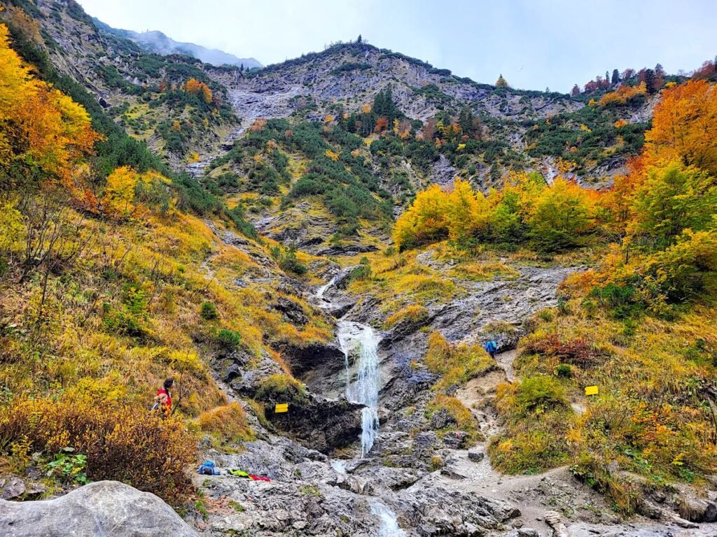
After a short stretch through the forest, the hiking trail leads along the Felsweißach into the Wolfsschlucht. The name “Wolfsschlucht” (wolfs gorge) is no coincidence: it is a particularly impressive, jagged rock gorge. The hiking trail through the Wolfsschlucht is extremely photogenic not least because of the two waterfalls. Heading into the small gorge you’ll find the first waterfall worth stopping at:
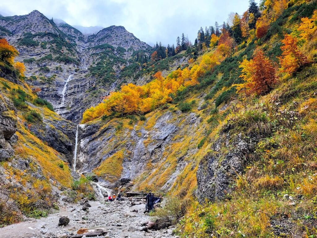
Shortly after you’ll pass through the larger Wolfsschlucht with the second waterfall. The hike up until the end of the gorge is easily doable for children and makes for a family day out in its own right, without going any further to the Schildenstein summit.
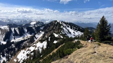
Wolfsschlucht – Schildenstein summit (2 hours)
Caution is advised from here on, starting with a slippery climb along the waterfall. Alpine experience is essential. If you feel unsafe, it’s advisable to end the hike here. This is the most demanding part of the trail. Once the climb out of the larger Wolfsschlucht is complete, you’ll need another 2 hours to reach the summit of the Schildenstein.
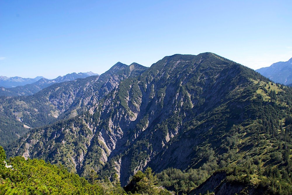
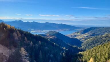
Although the Schildenstein is only 1613 meters above sea level, the view can easily compete with much higher mountains in the region.

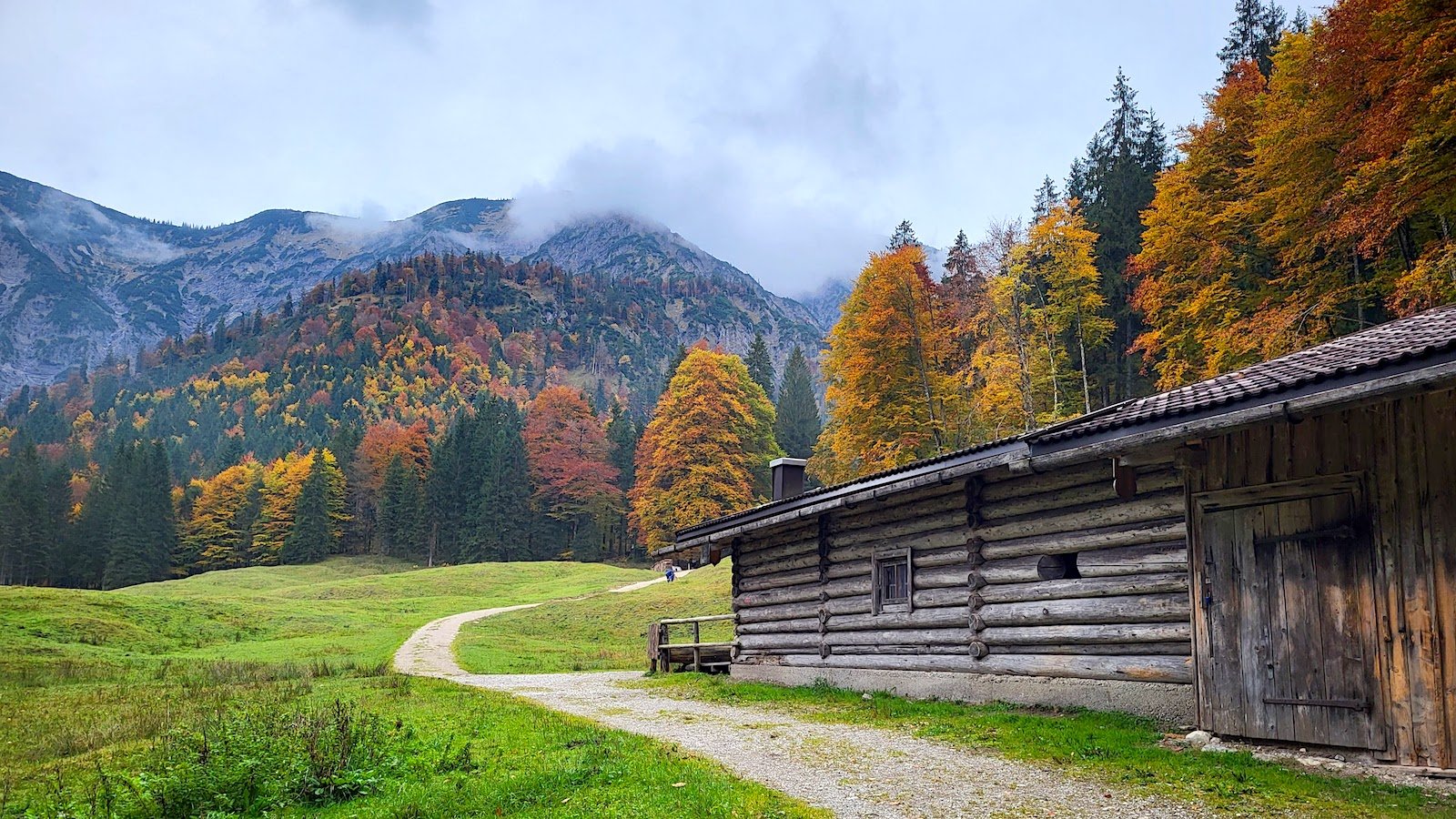
Schildenstein – Königsalm (1.5 hours)
On to the descent: Follow the signs towards Königsalm to stay on the loop circuit. This is a great place to stop for a drink or a bite to eat at the end of the hike. The historic Königsalm was built by King Maximilian I at the beginning of the 19th century and is today a popular, destination for hikers south of Lake Tegernsee.

Königsalm – Car Park (1 hour)
The last section of the circular hike from Schildenstein isn’t particularly difficult. Simply follow the signs towards “Gaißalm” and finally “Parkplatz Wildbad Kreuth”.
Summary
A loop hike of about 6 hours in total that is easily manageable with the exception of the technically deifficult section at the waterfall in the large Wolfsschlucht. Those who have the necessary experience for the climbing section will be rewarded with a great circular hike in the Blauberg mountains on Lake Tegernsee. If you don’t trust your climbing skills, simply turn around at the end of the Wolfsschlucht and head back to Siebenhütten, following the signs towards Königsalm.
Which season is best?
Due to the popularity of the Siebenhütten alm, the hike to the end of the Wolfsschlucht is particularly busy in the summer months. If you’d prefer to enjoy this scenic tour in peace, we recommend the short window of time in autumn, when Siebenhütten closes for the winter and the weather conditions still allow to hike the trail safely. Caution: do not attempt the ascent via the Wolfsschlucht in snow or icy conditions.